


WayPoints Mapper allows pilots to report weather conditions and share photos in a new social media tool.
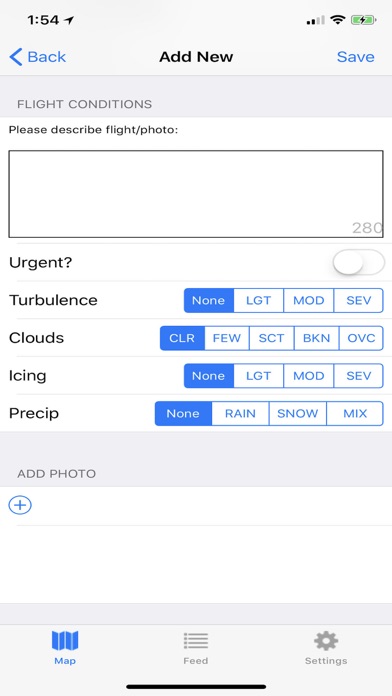
Using your devices GPS, note weather conditions and share an in-flight photo. Share a brief description. WayPoints Mapper will upload everything to the cloud whenever you have an internet connection, either at 7000 feet, or on the ground.
Forgot to leave an important report about turbulence or icing? While eating your $100 hamburger, open the app and long tap anywhere on the map to manually add a WayPoint at that location, enter the altitude, and youre all set.
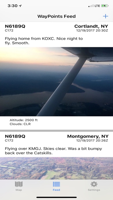
View the feed to see the most recent posts, or filter the map to see what is going on around the globe, or in your neck of the woods.
Show just your own reports to see a history of your flights, photos, and weather.
Coming in future versions:
Ability to report on Airport Restaurants
Additional weather categories
Ability to post to Twitter/Facebook, etc.
Much more...